Deep neural networks for multiple-point geostatistical simulation
Overview
Multiple-point geostatistical simulation is intimately related to texture synthesis and image analysis techniques in general.
Deep neural networks have seen an explosive development in recent years, with extraordinary results in many fields. Convolutional neural networks (CNN) are suited to image analysis, allowing feature extraction, classification, segmentation and reconstruction.
This research explores the architectures of CNNs appropriate for conditional simulation of random fields. These techniques can be applied in the context of mineral exploration and resources modelling to determine the expected spatial distribution of geological domains, given a limited number of conditional data, and a conceptual geological model that depicts the spatial features expected to be found in the deposit.
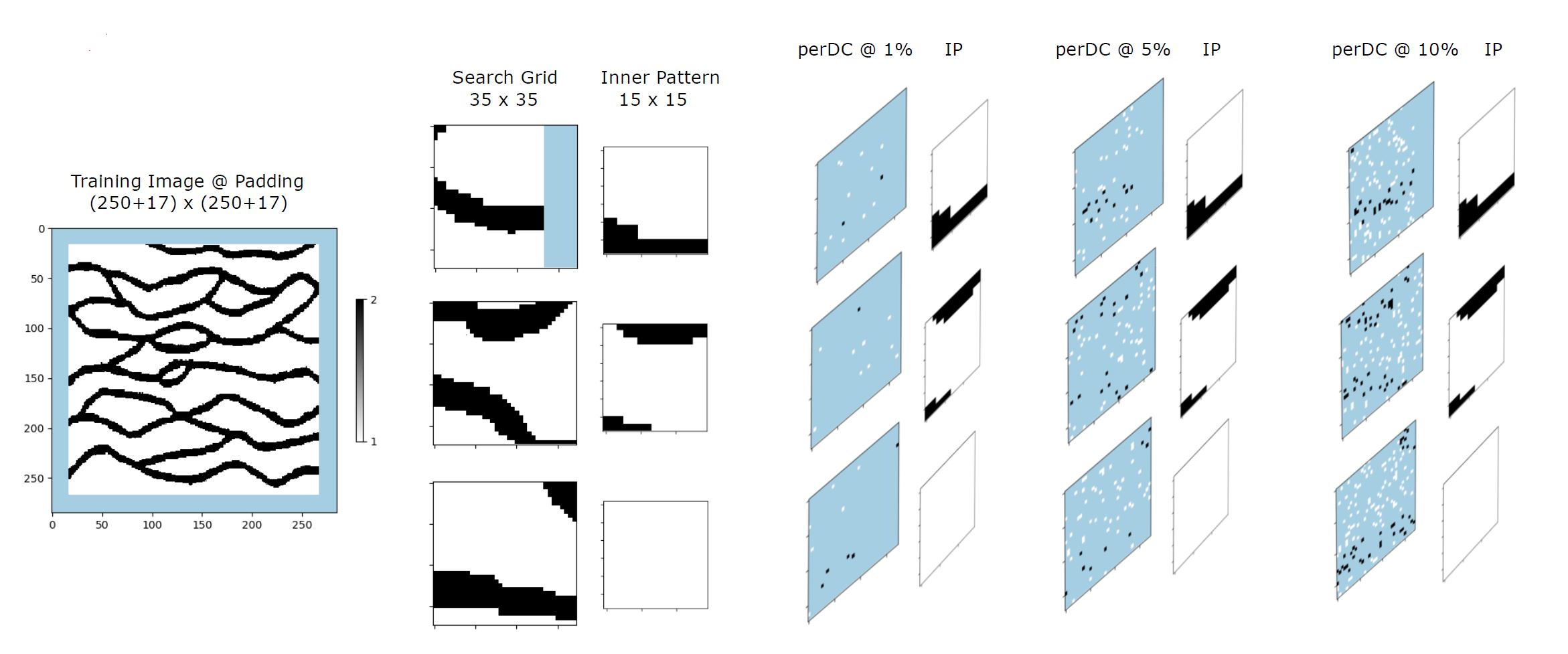
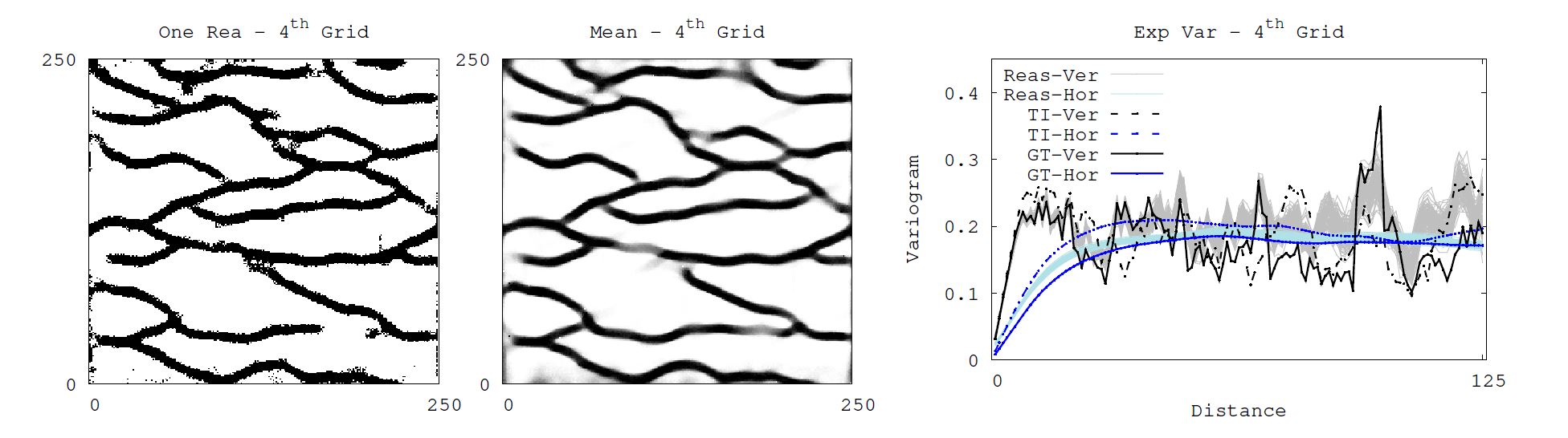
A recursive CNN is implemented to extract pattern features from a training image.
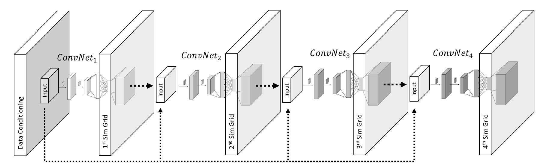
The RecCNN learns the pattern features from a training image, imposing different levels of conditioning.
A ground truth model that has the same continuity features as the training image is used to test the RecCNN.
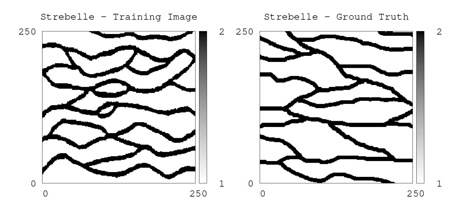
Simulation using the RecCNN generates multiple realizations that capture most of the spatial continuity of the geological units. The two-point spatial continuity is also reproduced. The E-type estimate predicts the location of most of the channels, with a very limited number of sample data as conditioning. This shows the potential of this technique.
Future work
Research continues looking at multi-categorical cases and continuous cases, as well as extensions to multivariate modeling and a full 3D implementation.
References
- Avalos S, Ortiz JM (2019) Recursive convolutional neural networks in a multiple-point statistical framework, in preparation.
- Calderón H, Silva JF, Ortiz JM, Egaña A (2015) Reconstruction of Channelized Geological Facies based on RIPless Compressed Sensing, Computers & Geosciences, 77: 54-65.
- Rezaee H, Asghari O, Koneshloo M, Ortiz JM (2014) Multiple-Point Geostatistical Simulation of Dykes: Application at Sungun Porphyry Copper System, Iran, Stochastic Environmental Research and Risk Assessment, 28: 1913-1927.
- Pérez C, Mariethoz G, Ortiz JM (2014) Verifying the high-order consistency of training images with data for multiple-point geostatistics, Computers & Geosciences, 70: 190-205.
- Peredo O, Ortiz JM, Herrero JR, Samaniego C (2014) Tuning and Hybrid Parallelization of a Genetic-based Multi-Point Statistics Simulation Code, Parallel Computing, 40: 144-158.